LONG ROUTE
Information on the route, stages, climbs, descents, lengths and altitudes.
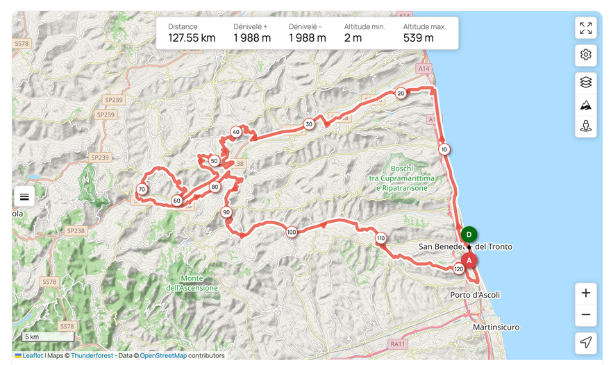
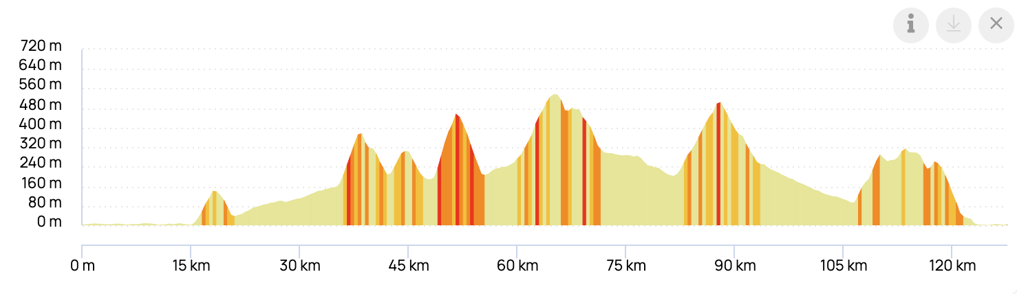
Mileage127.55 km
Difference in altitude
+1988 metersDifference in altitude
-1988 meters
Minimum altitude2 meters Maximum altitude 539 meters
Maximum slope19%
Climbs
- CAMPOFILONE: 3 km / 145 m dls / average gradient approximately 5% with maximum gradients of 9%
- MONTE VIDON FIGHTS: 3 km / 261 m dls / average gradient approximately 8% with maximum gradients of 18%
- PEAK OF THE CASTELLETTA DISTRICT, MONTERINALDO: 1.9 km / 178 m dls / average gradient 9% with max gradients 15/16%
- MONTELPARO: 4.47 km / 250 m dls / average gradient of approximately 5.5% with maximum gradients of 11%
- SALT HILL: 6 km / 300 m dls / average gradient of approximately 6% with max gradients of 10%
- BADGES, RIPATRANSONE: 3.9 km / 202 m dls / average gradient of approximately 6% with a maximum gradient of 12%
Refreshment PointsMonterinaldo, Montalto Marche, San Benedetto del Tronto.
Departure / Stages / Arrival
DEPARTURE: San Benedetto del Tronto > Grottammare > Cupra Marittima > Massignano > Campofilone > Montefiore dell'Aso > Carassai > Valmir > Monte Vidon Combatte junction
(route division) < Monte Vidon Combatte >Ortezzano, Monterinaldo, Montelparo, Ponte Maglio, Contrada Lago, Montalto Marche, Patrignone, Castignano, Cossignano, Offida, Ripatransone, Acquaviva Picena.
ARRIVAL: San Benedetto del Tronto Bruno Buozzi Avenue.
IMPORTANT NOTICE
Participants on the Long Route who find themselves at the junction of the two routes after 9:45 a.m. will be required to take the Short Route, due to the reopening of the San Benedetto seafront at 1:45 p.m.
Once they arrive on the San Benedetto seafront, they must proceed in the direction of travel along the seafront and reach the finish line.
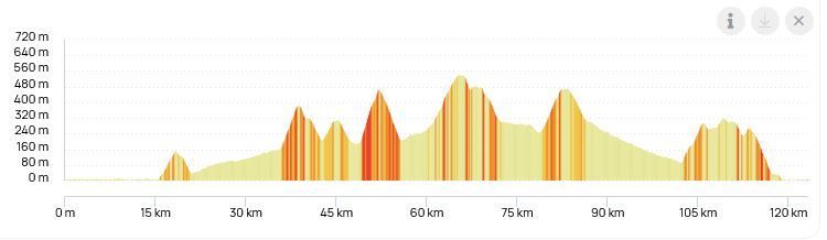
LONG ALTIMETRIC PROFILE
SHORT ROUTE
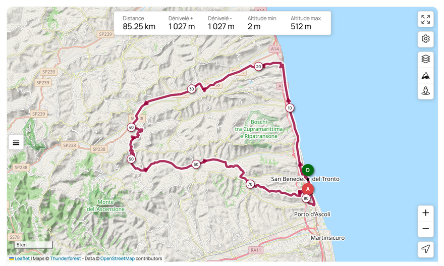
Information on the route, stages, climbs, descents, lengths and altitudes.
Mileage
85.25 km
Difference in altitude
+1027 meters
Difference in altitude - 1027
mt
Minimum altitude
2 meters
Maximum altitude
512 meters
Maximum slope15%
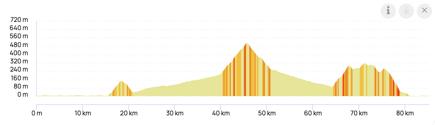
Climbs:
- CAMPOFILONE:and km / dls 145 m / average gradient approximately 5% with max gradients of 9%
- SALT HILL: 6 km / 300 m dls / average gradient of approximately 6% with max gradients of 10%
- BADGES, RIPATRANSONE: 3.9 km / 202 m dls / average gradient of approximately 6% with a maximum gradient of 1%
Refreshment Points Montalto Marche, San Benedetto del Tronto
Departure / Stages / Arrival
DEPARTURE: San Benedetto del Tronto
Bruno Buozzi Avenue.
Grottammare,Cupra Marittima, Massignano, Campofilone, Montefiore dell'Aso, Carassai, Valmir, crossroadsMonte Vidon Combatte (route division), Montalto Marche, Patrignone, Castignano, Cossignano, Offida, Ripatransone, Acquaviva Picena.
ARRIVAL: San Benedetto del Tronto Bruno Buozzi Avenue.
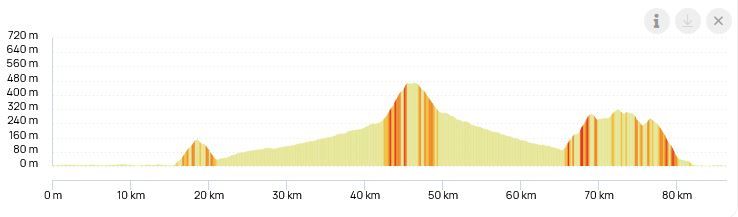
SHORT ALTIMETRIC PROFILE